Roads to Nowhere
In October 2016, The late Paul Walls, one of our trustees wrote about his fears for the Spalding Western relief Road. Paul was a District Councillor for Spalding Wygate Ward. By 2025, half of his prediction, complete with the bridge to nowhere had become true.
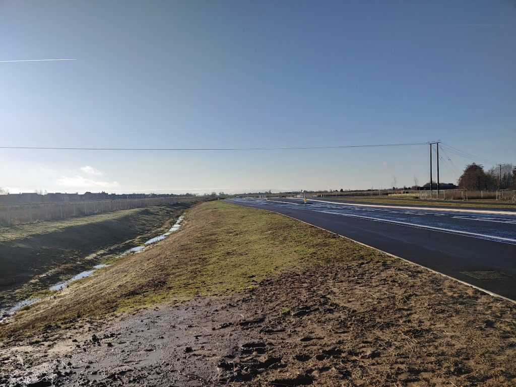
A spanking new road to reduce traffic congestion in the centre of Spalding. Sounds great. This South Western Relief Road would skirt the town from Luck’s Bridge (Spalding Common) to Wardentree Lane (on the Pinchbeck Road). The bad news is that it won’t have a middle section, not for 20 years or more. Just the outer sections – two bits of road to nowhere. Yet this is what the new Local Plan proposes.
Don’t blame the planners, though. This nonsense has been forced on them by the government’s doctrinaire demand that developers nowadays must pay for infrastructure, not the government. Strategic roads like the SWRR are enormously expensive of course, so it requires a lot of houses for a developer to be able to make the kind of profit that will finance such a road. Hence the size of Broadgate’s Holland Park estate on Spalding Common (over 2000 houses), needed to pay for a section of the SWRR.
At the Pinchbeck end, a similar huge housing programme will be required to pay for the northern third – regardless of the fact that it will virtually join up Spalding and Pinchbeck. Obviously it is felt there will be developers ready to undertake this huge proposed development north of the Vernatt’s.
No-one is yet sure, however, whether anyone will be interested in the middle section. Hence the gap.
We have put this analysis to both planning officers and John Hayes. They have not contested it. The consequences for town-centre traffic scarcely bear thinking about. Traffic that would have used the SWRR to bypass the town, had it been complete, will still have to come through the centre. The huge developments supporting the two unconnected outer sections (roughly 6000 new households) will be meanwhile pumping extra vehicles onto the roads. (County Highways assesses an average of 8-10 vehicular movements a day per new urban household.) Most of them will be short urban journeys into Spalding, where the increased congestion will be further compounded by more trains on the up-graded railway line.
Further, one wonders where all the extra residents will be working, and whether there won’t be a lot more commuting to Peterborough – subverting the new Local Plan’s aim to reduce the use of motor vehicles.
In terms of controlled organic growth, does Spalding really need roughly 15,000 extra residents during the next 20 years? On these sites? Or is it all being dictated by the government’s perverse approach to funding infrastructure needs?